September 2015
Day 1, Thursday evening: The expedition members met south of Aubrey Falls and setup camp. We drove through quite a bit of rain most of the journey north, but it suddenly cleared up just in time for the beginning of our adventure. We got the fire going, everyone arrived safely, and the stars came out for the night.


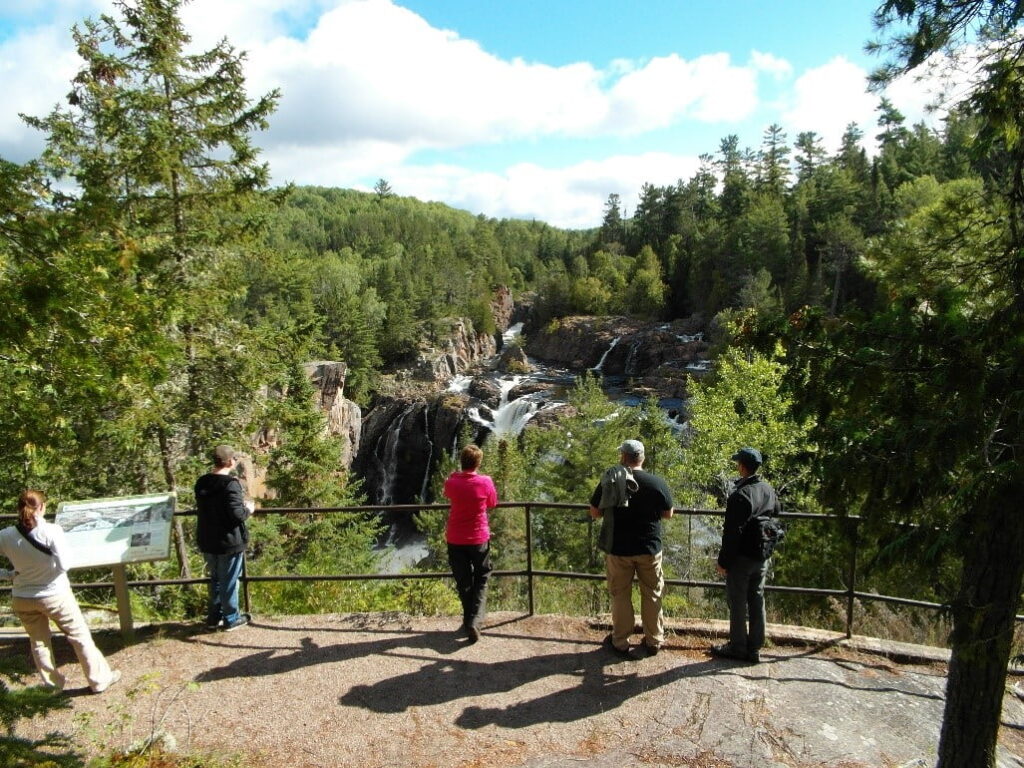
Day 2, Friday: We decided to break camp and take some trails to the Aubrey Falls Outfitters in order to top off the fuel tanks and some coffee mugs. Starting off with full tanks would be critical to being able to finish our journey through the isolated interior of the Algoma Highlands. The team hiked to Aubrey Falls to check out the 53 meter waterfall. We were welcomed by lots of granite cliffs, a bridge over the gorge, and awesome views.


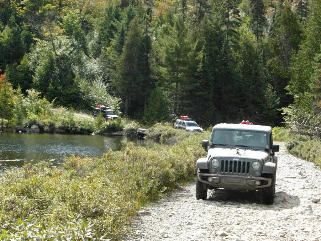
We then headed west into the unknown. We travelled along snowmobile trails, ATV trails, and small logging roads. There were challenges such as rough, narrow trails, one rocky, steep trail climb, and a few small water crossings. The original intended route was blocked and overgrown because of lack of use.

The decision was made to backtrack, head south, and take Ranger Lake Road to make up time and get to Ogidaki Mountain before dark. The trail to Ogidaki Mountain was on the verge of being too small for the vehicles, but we continued.
There was a small water crossing and a small ditch to traverse. We made it to the abandoned Ranger Cabin about half way up the mountain and set up camp. It was time to eat some dinner and tell stories of today’s travels around the campfire. The stars were bright and we could even see the faint glimmer of the Northern Lights. Good ending to a long day of trail running! The team was moving for over 8 hours and travelled 125 miles of dirt roads and trails. Moving average speed of 16.9mph.
Day 3, Saturday: The team woke up to 36 degrees and clear skies. We found an ideal spot for future camping right on a lake. Also, a beautiful spot crossing the bridge over the Goulais River. Ate lunch lakeside on the rocky trail that is under water during the spring.

We continued on crossing the Algoma Central Railroad at Mekatina. We passed a gentleman in a small pickup that said the trail had 3 large water crossings ahead and we should turn back. But, you know, we had to see for ourselves. We had many creek crossings that were easily traversed by the expedition vehicles. Most of these crossings used to be bridges and culverts but have been extensively damaged or removed and bypasses were formed.

The team tackled the challenge and asked what’s next. Onward to Batchawana Mountain. We were attempting to climb to the top of the mountain on an ATV trail. Let’s just say the vehicles have a few new “racing stripes”. The teams travel slowed to a crawl. The decision to stop and backtrack was a hard one, but we were running low on fuel and daylight. The teams had to back down the trail in reverse.
About half way down the mountain we noticed the Maintenance Station had satellite Wi-Fi available. We took a few minutes to jump online and send a messages telling our families we were safe and having fun. Some of the team were beginning to tap into their fuel reserves due to the longer alternate routes and the worse than anticipated trail conditions. The decision was made to alter our route and goals for the day. This is part of any expedition. The planed route was to head to Batchawana Village and cross the river to access the Tribag Copper Mines from the north. It was time to head back to civilization and fill up.
We traveled south to ON-17 and visited our friends at the Voyageurs’ Lodge. A quick refuel, grabbed some snacks, and we were back on the alternate trail heading north for Tribag Mines. We travelled on Tribag Mine road where we crossed paths with a local couple. They told us to turn around because the bridges were out. Well, you know, we kept going. We were travelling along the beautiful Batchawana River. We stopped to enjoy the scenery at Batchawana Falls and take a few pictures. The river was way up, so the falls were amazing.

We continued on until one of the broken bridges was found. This one had a trail bypass down through the creek but was very muddy. After careful examination of the bypass, someone was volunteered to drive through it. They made it and we proceeded to send each vehicle through one at a time. All of the expedition rigs made it safely through this challenge as the confidence of the drivers continued to rise.


Onward towards the mines. At the next bridge outage we were not so lucky. There was no bypass and the bridge would definitely not hold the weight of a loaded vehicle. A scout was sent ahead on foot to check the condition of the trail, while we brainstormed on how we could use what was there to get 6 vehicles across in a hurry. We had another hard decision to make.
It was near dark, the trail ahead narrowed to the size of an ATV. With 9 miles still to go and significant work to rebuild a bridge, the decision was made to turn back and find a spot to camp. We found a small gravel pit off the trail that would serve as camp for the night. Again, the stars came out, we enjoyed dinner and games around the campfire, and great stories. The team was moving for nearly 7 hours and travelled 80 miles of dirt roads and trails. Moving average speed of 12.8mph.
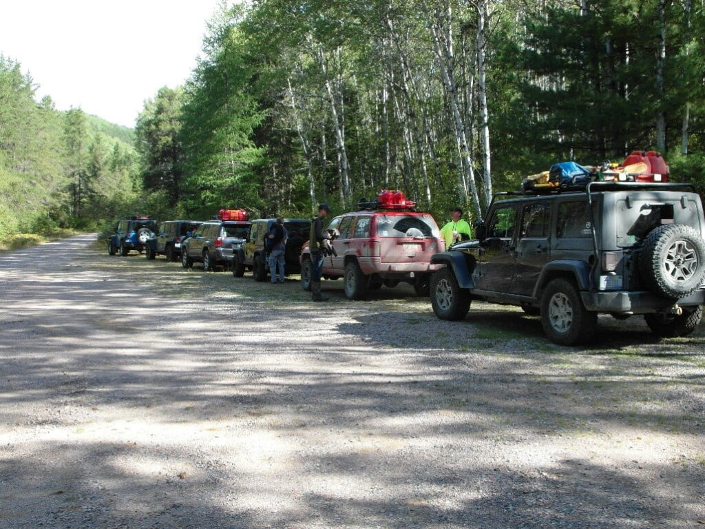
Day 4, Sunday: Again, the team woke up to a brisk 36 degrees. Today was our last day together. Started a small campfire, and began to pack up everything to head out of the woods. We took the opportunity to take group photos of the team and their expedition rigs. We still have a challenge ahead to make it out, the first bridge bypass through the mud.

Each driver took their turn diving their vehicles into the mud and water, emerging out on the other side with skill. We made our way out to ON-17 and back to Voyageurs’ Lodge for a good hot breakfast and expedition review. We learned from locals, that in days prior to our arrival, three large thunderstorms rolled through the area, dropping approximately one foot of rain in the region north of Batchawana Bay. This explains the high water levels in the Batchawana River which would have make the river crossing impossible upstream. After eating, a few members ventured across the street to jump into the frigid waters of Lake Superior! From there, we said our goodbyes and started south to the border and eventually home.

Although the goal of following an intended route was not met due to unknown trail conditions, we feel the expedition was a success. Each of the team members came prepared, had the skills, motivation, patience, humility, and overland expedition vehicle to travel deep into the wilderness and return safely. We were faced with challenges and obstacles, so we adjusted, adapted to the conditions, and continued on. It is probably safe to say each team member was challenged in some way and learned things about themselves and their vehicle which will be the foundation of future more challenging trips.
-Jeremy “Blue” Werner
Expedition Leader
Fortune Bay Expedition Team