It was an interesting experience leading people on a solo expedition. Normally, everyone spends most of their time together, and it is all about teamwork and group activities. This time, we delivered everyone to their individual campsites where they were to stay alone for 2 days. That gave me a chance to do some exploring on my own.

Our GIS Specialist asked a couple of us to collect some data while we were on the island. He wanted waypoints for anything that looked interesting that could be added to future maps. In addition, there were few specific sites that he wanted us to check out. Dane’s Farm is located on the northeast side of the island, and the trail starts on the edge of the schoolhouse clearing. He asked me to check on the condition of the trail, and to see if there were any existing ruins left on the farm.
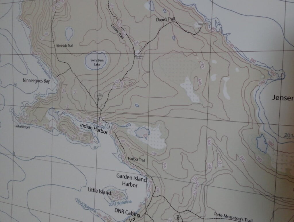
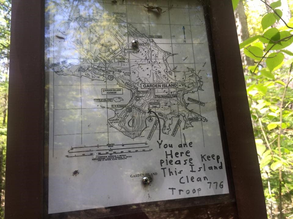
The schoolhouse clearing was completely filled with juniper bushes and I didn’t see any ruins there. Juniper bushes are a landscaping shrub, and their presence indicates that something used to be there. The bushes were totally overgrown. They were so big that it was easier to climb over the top of them than to try to fit in between. There was a signpost at the beginning of Danes Trail with a map that looked similar to the one pictured below. Someone wrote “you are here” in pencil, marking the start of the trail on the map, and it said that it was placed by Troop 776. From the signpost, you couldn’t see the trail at all. I followed my compass and pushed my way between a couple of pine trees. Once I made it through, the trail was right there.
There were so many huge trees down on the trail to Dane’s Farm, and it was very overgrown. It would take a lot of work to clear that trail because it’s in pretty rough shape. Someone had marked part of the trail with flagging tape. I was able to follow it okay until after it turned southeast. There was a massive tree crossing the trail that was very difficult to get around. I thought I found the trail again after that, but it was hard to tell. It seemed like it was there and then gone again. Eventually, I lost it completely. I wondered if I was a little bit south of it, or maybe it wasn’t there anymore. When I turned to head northeast toward the farm, I wasn’t on a trail at all. Eventually, there were rows of pine trees as I got close to the farm, so that was reassuring.
It was a great feeling when I finally reached the open field. The first thing I saw was a huge blooming apple tree. It was beautiful! When I saw the apple tree, I knew that I was in the right place. Then off to the side I could see the cabin ruins. The roof had collapsed, but the walls were still standing. The east side of the building is in the woods, and I’m glad that I decided to push through the trees to see it because there was a cellar that wasn’t visible from the clearing. The cellar walls were made out of fieldstone, and they were still intact. There was a beam that had collapsed into it. It was pretty neat, and I would definitely repeat that arduous hike to see it again.
When it was time to hike back, I looked all along the edge of the field to see if I could find a trail leaving from the south side of the clearing, and there was nothing that I could find. Unfortunately, it took me a while to locate the trail going back, and it was not easy going through the woods. Most of the ground was covered in water that was between ankle and mid-shin deep, but it wasn’t mushy like you would expect in a swamp. It rained pretty much that whole day, and it was coming down hard when I was out there. I wonder if it dries up in the summer. The whole area was thick with down trees without a good way around, and that made it very slow going until I eventually found the trail. I was over halfway back to the schoolhouse clearing before I finally found it.
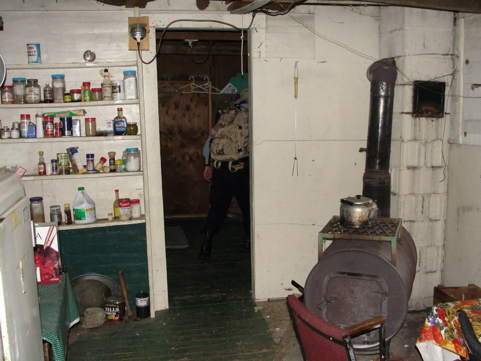
Once I was back on the trail, it was much easier, and the return trip suddenly seemed like nothing. I climbed back over the field of juniper bushes, and then took the Center Trail south until I reached Lake Michigan at Indian Harbor. Just as I was emerging from the woods, I received a call on my radio saying that our RIT team had built a fire inside the DNR cabin, so there would be a place for me to warm up and dry off. That was the best possible ending to a great hike!
– AR
___________________________________________________________

Amy “AR” Colby
Curriculum Director
Instructor
Expedition Leader
(Active)
Special Certifications/Achievements: NASAR SARTECH I/II/III, NASAR SARTECH II Evaluator, Wilderness First Responder (WFR), FCC Technician License
About Me: I’ve been hiking in the woods since I learned to walk. Actually, I remember riding on my grandpa’s shoulders! I grew up camping and playing in the woods. I have been running and mountain biking for almost 20 years and backpacking and competed in triathlons for nearly 18. I have competed in 22 adventure races. I also enjoy skiing, snowshoeing, and kayaking!